Tucson: Santa Catalina Mountains
Finger Rock Trail in the Santa Catalina Mountains

Exclusive images by Tucson photographer Chad E. Might
“The southern slope of the Santa Catalinas, visible from Tucson, consists of one, single, undivided range, running from the mouth of the Sabino canyon to La Punta de la Sierra on the west, On this range are La Ventana, The Finger, Rifle Notch, the Clay Banks, and the Church peaks, all visible from Tucson.”
From Arizona Arbors, An Immense Growth of Native Timber. The Santa Catalina Mountains and Their Extensive- Vast Timber Wealth, from Ira Carter, Citizen reporter. From the Weekly Citizen, January 19, 1884.
By Chad E. Might
The Finger Rock Trail combines moderate to intense hiking along the Santa Catalina Mountains up some winding majestic areas.
During my recent hike, I was visited by a deer running through the brush, just as I was descending down to the beginning of the trail.
I was lucky that it rained earlier in the day, making a heavenly surreal light glow upon the whole mountain and dessert landscape. There are scenic views of both the city & mountains throughout and there is a good chance you may come across the wildlife that inhabits the area.
When we hike outside of the city, we leave are homes & enter an animals kingdom.

Bring plenty of water and block out a good 5-7 hours if hiking to the top. Finger Rock Trail is located towards the end of N. Alvernon Way and Skyline Rd., just before the gated community.


See More Finger Rock Trail Photos
Courtesy of Might Photography
Chad E. Might
(520) 488-6834
www.MightPhotography.com
November Tucson Events
Tucson Calendar of Events
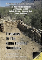
Treasures of the Santa Catalina Mountains
Finger Rock in Tucson's History
 1883: The Story Of The “Stone Church”
Tucson Judge Charles H. Meyer related an obscure story of an Indian tribe and lost ruins near La Ventaña in an 1883 Tucson newspaper article about the “Stone Church.” The respected local judge told a reporter about a roaming group of Indians who were constantly chased by the Apaches from the San Pedro River into the Santa Catalina Mountains through the Cañada del Oro and back into the Catalina Mountains somewhere near Ventaña Canyon and Finger Rock Mountain, on the south side of the Santa Catalina Mountains. There, they built a polished granite stone church with a stone mosaic floor. To find out more, read "Treasures of the Santa Catalinas."
Mining Near La Ventana
On the south side of the Santa Catalina Mountains, six miles north of Ft. Lowell ruins on Swan and Skyline Road, is the 942 The land is now surrounded by private homes, including Skyline Country Club Estates. At one time rancher George Wilson who had interests in the Cañada del Oro area had owned the mines. These nearby small mines are both one league from La Ventaña. The Cargodera is a mile or less from “a large ‘town’ on a mesa” that was a large Hohokam village dating to 1200AD. To find out more, read "Treasures of the Santa Catalinas."
Discover the legends and rich history of the Santa Catalina Mountains. Learn about the Iron Door Mine, Spanish Jesuit treasures, Buffalo Bill's mines, gold mining in Oracle when pioneers arrived to prospect the Catalina Mountains. Visit the "Treasures of the Santa Catalinas" and read stories forgotten in time. Available at a discount on Amazon.
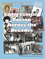 "Entertaining Tucson
Across the Decades"
Read about the local Tucson entertainment scene from the 1950s through the 1990s. Over 700 pages of pages of musician interviews, thousands of local musicians, original photographs and stories. If you played in a band or went to a nightclub during those years, you'll be familiar with many of these people and places. Published by Entertainment Magazine. Read sample pages Entertaining Tucson Across the Decades. Find your name or photo! Now available, at a discount, on Amazon.com.